NYC 2016: Experiencing the city by bike

I noticed right at the beginning of the residency month that using only the subway and walking was going to kill my feet. We thought cycling is an answer for that. I have previously done sightseeing in many cities from Kyoto to Berlin by bike and found it a nice way to get to know the city. Biking in a much larger city like New York made me a bit nervous in the beginning, even though I knew that numerous procedures done in recent years makes it easier and safer to bike in NYC nowadays.

How did NYC become (more) bike-friendly

The change into a bike-friendly environment happened thanks to Janette Sadik-Khan, a former Transportation commissioner of New York City. As she tells herself, in just two years after she started in the job, they had created a 200-mile bike lane network in NYC, doubling the existing 220 miles of bike lanes. I didn’t happen without resistance. One of the hottest arguments was about bringing a bike lane to Prospect Park West. Park Slope next to Prospect Park happens to be a nice and expensive neighbourhood. Prospect Park West on the other hand didn’t seem heavily trafficked at all when we went there one Friday afternoon, one of the busiest rush hours of the week. Clearly the bike lane has not been the disaster opponents were expecting, even though a former 3-lane street was transformed to a 2-laner. Actually quite the opposite has happened, since the number of accidents has decreased and traffic flow has improved, as Jeff Speck tells in his book Walkable City.
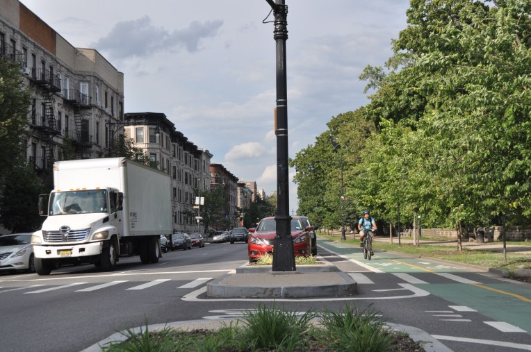
NYC (285).JPGProspect Park West.2012guidance_protectedcycletrack
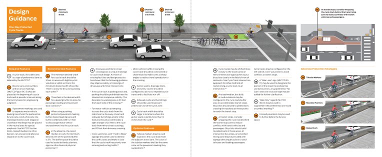
NYC’s Department of Traffic has worked closely with NACTO in creating street design principles. Here is an example from NACTO’s Urban Bikeway Design Guide 

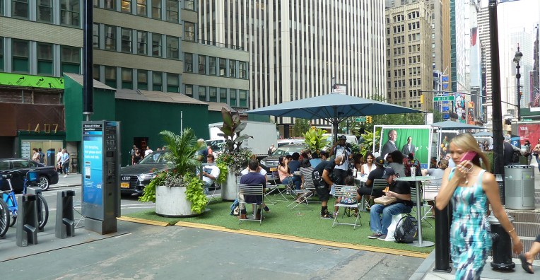
Broadway bike lane and plazas

In 2008, the vehicle lanes of one of the most prominent and central streets of NYC, Broadway, were narrowed down to make room for a bike lane. Simultaneously, a series of plazas were created in the corners where diagonal Broadway meets avenues from Times Square to Union Square. In some of these plazas all motored vehicle traffic is forbidden.

NYC (552).JPG
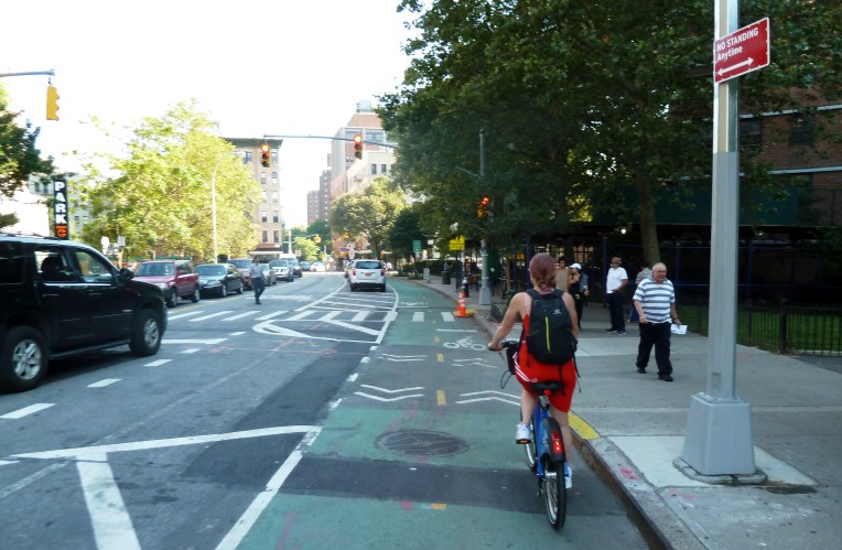
Cycling in Broadway.

In action it seemed that the bike lanes and plazas slowed the motored traffic down a bit, but at the same time speeded up cycling tremendously. The sense of safety, which I very much appreciate, was better than in most streets of Helsinki. Plazas were cozy and popular places to sit down, even though they looked temporary (on purpose). It was actually hard to imagine Broadway how it must have looked like before the change.

PLACES0.jpgPlaza and a Citi Bike station along Broadway.

Biking environment in general

Subway stations are usually about ten streets or roughly one kilometer apart, and they run effectively only towards downtown both in Manhattan and Brooklyn. Luckily New York City has a Citi Bike system since 2013 and we decided to give it a try.

citibike.JPG
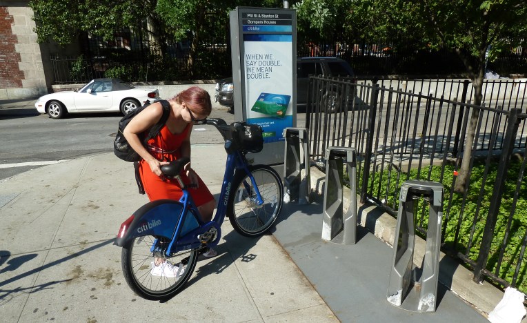
Adjusting a Citi Bike.

Citi Bike was super easy to use and we found it affordable. You can choose between a 1-day pass, a 3-day pass or a yearly membership. You find the whole station map on their website. As usually in shared bike systems, you have to return the bike within a half an hour, but you can take as many rides as you want to. Citi Bikes are apparently popular in work commuting. During rush hour and near big workplaces Citi Bike stations were sometimes empty, but otherwise there was always a bike to rent.

We explored the city by bike several times. The combination of subway and Citi Bike worked seamlessly together and we didn’t have to walk in the heat any more than necessary. Manhattan traffic culture was quite forgiving towards cyclists and car traffic was so slow that fears quickly disappeared. It felt different to cycle in less central areas of Brooklyn, where driver is still clearly the king.

NYC (389).JPG
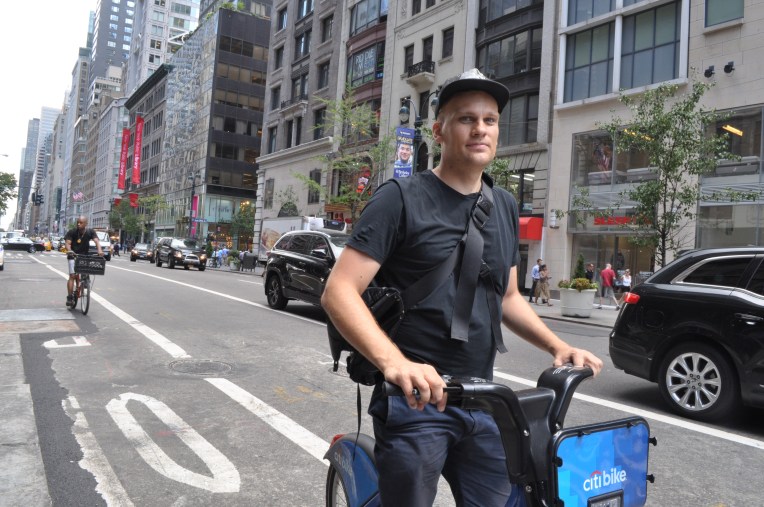
Cycling in Midtown Manhattan.

All in all, New York City has succeeded making cycling a real, approachable option in commuting and moving in the city. This has happened in just a few years, and the walking environment has improved a lot at the same time. We have a bike boom in Finland as well, so let’s keep it growing! If change  is possible in NYC, it is possible anywhere!

– Laura


NYC 2016: Street & park events

They claim that during August, every New Yorker escapes the heat to Long Island, but the city has been anything but dead. We have bumped into some awesome summer events all over New York.

New York is a big city in population as well as in distances, but the city structure of conjoined villages makes it easy to approach. Different neighbourhoods have their own characters and local events, which are often not too big at all.

NYC park events

As I mentioned earlier, we went to see a free movie to Brooklyn Bridge Park one night. I was delighted that the movie night was well put together, yet it was not too crowded at all. I noticed that there is an impressive list of events in the park during the summer season: from kayaking and basketball to horticultural volunteering. Part of the events run understandably spring through fall only, but all in all the event calendar covers the whole year. I find this kind of an approach a real asset for the neighbourhood, increasing livability and expanding scarce living area to outdoors. As the public spaces are used more, it improves social control and thus the feeling of safety, and maybe even increases the value of the nearby apartments.

NYC (608).JPGBrooklyn Bridge Park joggers

Besides movies, there are a lot of free or low-cost events in parks all over the city. The events are gathered under one website, where you can also filter the events according to the area or activity type.

I have tried different yoga and pilates classes in Fort Tryon Park, Hudson River Park and Jane Bailey Memorial Garden. They have all been very professional and a good way to get to know NYC parks. There are so many options all over the city that groups tend to stay small and you can just sneak in. I think these kind of easily accessible events could work for example in Helsinki, too. In best case scenario you develop a closer relationship to your neighbourhood community when you start going to your local yoga.

pilates.jpg
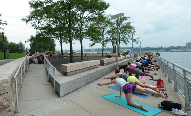
Hudson River Park pilates

jooga.jpg
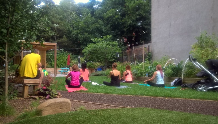
Jane Bailey Memorial Garden yoga

BRIC Celebrate Brooklyn! Festival

Celebrate Brooklyn! Festival is a one of New York City’s longest running, free, outdoor performing arts festivals and it takes place in Brooklyn’s Prospect Park. It was launched in 1979 and the organizer, Brooklyn Information & Culture or BRIC, claims that the event was an early anchor in the park’s revitalization and brought people back to the park after years of neglect. Naturally, they work in cooperation with the New York City Department of Parks & Recreation and the Prospect Park Alliance.

Two weeks ago, on a Friday night, we happened to pass by the Prospect Park festival venue and decided to stay for the concert. The performers were a psych-pop band Dr. Dog with an orchestra collective the Knights. The event was free, even though they hoped for a small donation of a few dollars at the door. Despite it being free, the venue was professionally executed, nicely decorated, not too crowded and there was plenty of lawn to lay down your picnic quilt. The food trucks deserve a special mention, because food was delicious, local and reasonably priced.

NYC 2016 känny (163).jpgCelebrate Brooklyn!

I was once again impressed how a free event can be of such high quality. Obviously, a free lunch is never free, and this event is largely funded by Friends of BRIC Celebrate Brooklyn!. There are different donor levels and benefits accordingly. I am sure that this event gathers a lot of donors since it has a distinct image and sense of locality combined with a tradition.

Street events

A long tradition is New York City is to to open up their streets to pedestrians for play on a recurrent basis under Play Streets Program. For schools and community groups with insufficient active play spaces, Play Streets open up streets in quieter blocks for physical activity. The change is meant to be permanent, but it can be easily dismantled if there was a need to do so.

I visited 78th street Play Street in Jackson Heights. The location is ideal, between a playground and a school. It is a renowned public space improval that started with the community initiative. The project began in 2007 when a group of neighborhood activists, the Jackson Heights Green Alliance (JH Green) wanted to improve and increase the amount of public space in their neighborhood. The street was quiet during the day, but even some benches and trees are obviously a welcome sign to spend time on the public space instead of walking by, or worse, driving by.

NYC (209).JPG
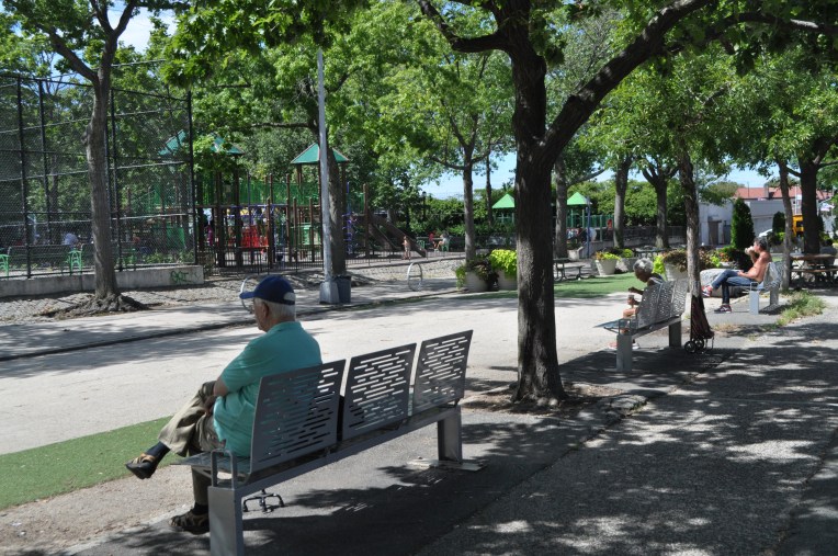
A Play Street in Jackson Heights, Queens.

When talking about temporary street closures, Summer Streets should be mentioned. We took part in it the first Saturday of August. There will be more on that in Tomi’s recently released blog entry!

…and more

Pop-up events seem very trendy in New York at the moment. I actually noticed an event series called Pop Up New York, where they close a part of a central street every now and then to open it for people, food and live music.  think I am going to check it out this weekend.

– Laura

NYC 2016: Summer Streets

On our first weekend here in NYC we participated in the annual Summer Streets event. It is a street celebration where nearly seven miles of streets in Manhattan, mainly Park Avenue are closed from motorized traffic and opened to the public to exploit it on foot or on a bicycle. Additionally, a big part of the intersections were closed as well and where there was crossing traffic, crossing supervisors and even police officers helped people get through safely. The event was held this year on the first three Saturdays in August between 7 am and 1 pm.

The idea for the event came from Medellín, Colombia, where they have been arranging temporary street closures on Sundays and public holidays. NYC’s first Summer Streets was arranged in 2008 and after almost a decade of arranging it, it has a long list of partners that provide activities during the event and it seems to attract a large crowd. The idea of regular street closures has also spread to other major cities around the globe, including London and Paris.

kollaasi1.jpg
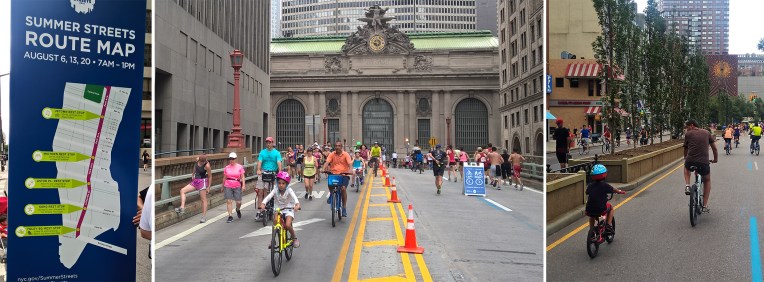
The Summer Streets route map and a few views of the event

We started our exploration of the event relatively early, at 9 am and hit the route towards the grand Park Avenue. In the morning hours there were times you couldn’t see that many other cyclist or runners around so the avenue felt really spacious. It reminded me of a scene from the movie Vanilla Sky where Tom Cruise cruises around empty streets of NYC… Somehow it was a little disappointing at first that the streets weren’t packed with people. But actually, it was kind of cool to experience a major city street that way, meaning that as a pedestrian or a cyclist you are so used to the idea that you should stay on the edges of streets and keep out of the way of “real” (read cars) traffic.

summerstreet1
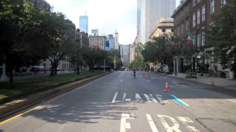
At the early hours Park Avenue looked deserted at times…

summerstreet2
…but streets started to fill up soon.
summerstreet3
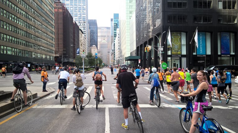
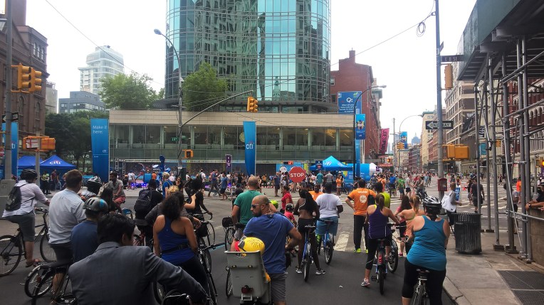
Towards the end of the event there was already a pedestrian and bicycle rush hour

Being suddenly able to choose whatever lane you want and set the pace as you prefer was not only empowering and sort of cool, but also it allowed you to see the street in a totally new perspective. It is not often that you have so much time to observe sight-line endings and street side buildings. Usually there is only time for seeing the things on the ground floors of the buildings since you are concentrating on the traffic. The experience must be even more empowering for kids and other people who are not used to cycling amongst heavy traffic.

different_groups
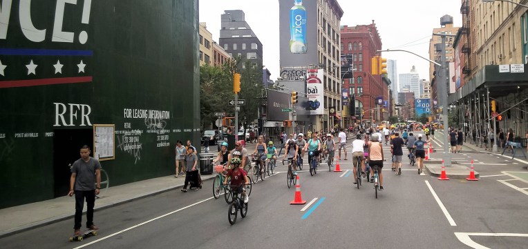
Summer Streets attracted cyclist from different age groups

The event was of course not only about cycling. There were actually a lot of people running, walking and just lingering back and forth Park Avenue. We ran part of the route and it was great fun as you could imagine yourself taking part on a New York City marathon.

Laura_running
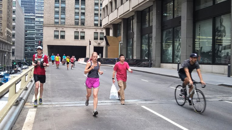
Speeding through Park Avenue on foot

There were lots of other activities offered on five rest stops, including a zip-line, educational and informational stands by co-operators, art performances and fitness classes. Especially the dance-classes offered by a local studio had a nice impact on the crowd as passers-by started to spontaneously join the fun. On our journey we also stopped by at a farmer’s market along the route.

summerstreet4
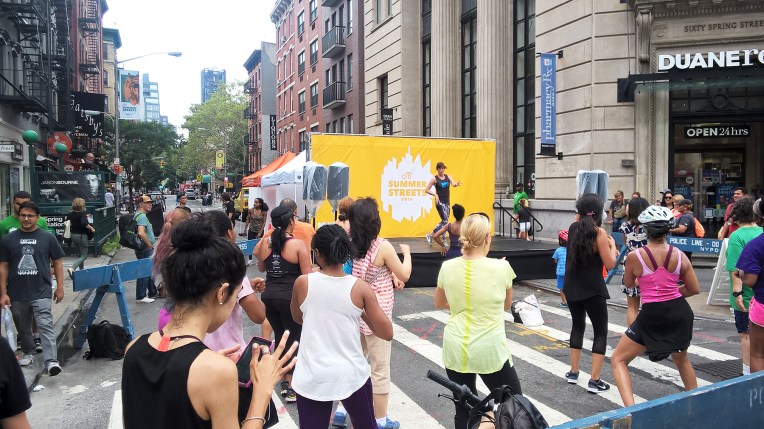
At the last one of our stops it was a full-on street festival with during the public dance classes

vihanneksetFarmer’s market: wow, such nice groceries!

It is no wonder that temporary street closures are listed as one of interim design strategies in NACTO’s Urban Street Design Guide. I’ve been impressed here in NYC  about the not-so-polished interim designs to add bike lanes or make lane diets to streets. The street closures add another layer to thinking differently about streets as it lets you imagine in a real setting what it would be like if our streets were not dominated by cars. For example, it was great to have Kurvi Block Party in Helsinki last summer to close part of Hämeentie from motor vehicles. We should really get a regular event like Summer Streets in Helsinki as well. I think that giving us a chance to see a radically different use for streets more often would help us better imagine a streetscape that doesn’t have to be dominated by cars.

-Tomi


NYC 2016: Visiting NACTO

We got the opportunity to visit the National Association of City Transportation Officials’ (NACTO) headquarters here in NYC last week and meet two members of their Global Designing Cities Initiative program.  NACTO is a non-profit coalition between 42 US  and 4 international cities (Canada and Mexico) that promotes cities’ interest in federal decision making regarding transportation and works as a knowledge sharing network. As mentioned before as a part of the knowledge sharing they’ve made an impressive set of street design manuals with distinctive, comprehensible and high-class visuals.

nactovisuals
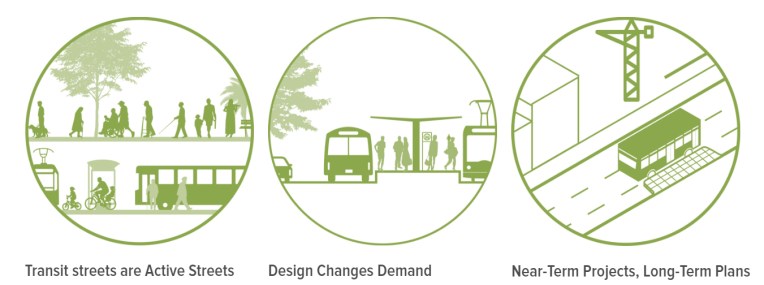
image 1: Example of the appealing visuals of Transit Street Design Guide by NACTO

I first came across with NACTO’s guidebooks when I was working in WSP Finland on a project to set principles for designing Espoo’s city centers to more urban areas. Going deeper into the ingredients of urbanity, walkability stood out as one of the main components of urban neighborhoods. Most of the (sub)urban centers in Finland are missing a public environment and streets that encourage to walk. Looking through Finnish cities’ street dimensioning manuals I noticed that most of them could be improved with a more complete spatial vision of streetscapes (image 2 shows a typical representation of street type). This is why I started to look for examples from abroad.

HKI-pääkatuimage 2: A typical Finnish depiction of a street type. 

As it turns out, we are not of course alone with our pursue for walkability and automobile-centric practices in designing streets are still a norm also here in the US. As Jeff Speck puts it in his book Walkable City “What characterizes the discussion on cities these days is not a wrongheadedness or a lack of awareness about what needs to be done, but rather a complete disconnect between that awareness and the actions of those responsible for the physical form of our communities”. Like in Finland, also in the US urban street design is often hampered by instructions made for either suburban or highway conditions that lack the understanding of streetscapes as important public spaces. That’s the reason why e.g. NYC Department of Traffic lead by commissioner Janette Sadik-Khan worked with NACTO on street designs more appropriate for city needs.

Seeing NACTO’s Urban Street Design Guide is like a breath of fresh air among street manuals. It is immediately comprehensible and it has great visuals to support the ideas. Already in the beginning of the book the street design principles set the tone for human-centric and versatile approach (see the principles below in picture 3).

NACTO-street-principles
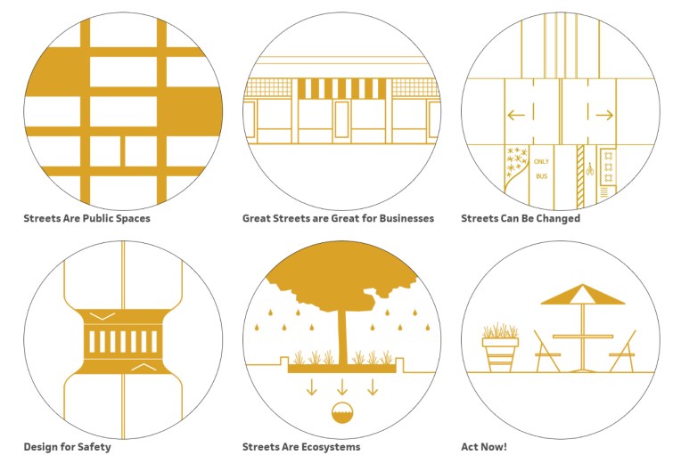
image 3: Street design principles from Urban Street Design Guide by NACTO

Downtown Transit corrdi.jpg
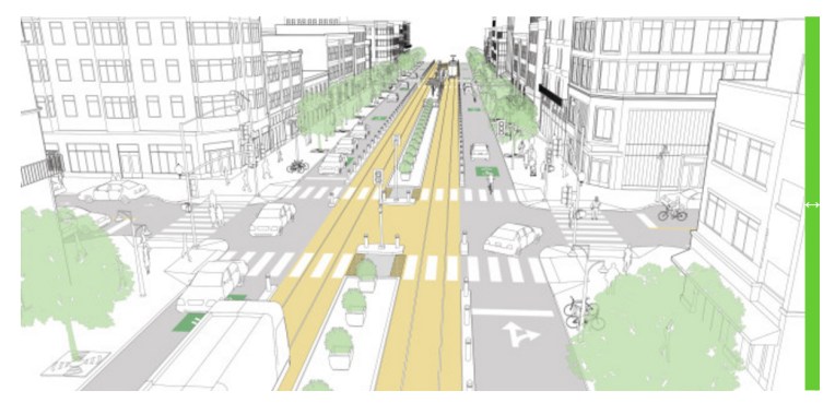
image 4: Downtown transit street from Transit Street Design Guide by NACTO

Taking things to the global level

We were super lucky to get an appointment now in August since it was a hectic time in NACTO’s office: they are just about to publish a new book called Global Street Design Guide. A guidebook that tries to address street design issues on a global level might feel a bit of an exaggeration at first, but when it comes to walkability and streets as public space, things are truly global. After all, doing pedestrian-friendly environment is about human dimensions which are universal. And as we got to see some sections from the upcoming book, human-centered design is indeed the focal point of the book as seen in the great visual seen in image 5. Helsinki has also made a similar prioritization in its traffic development plan but yet again NACTO does the same accompanied with great complementing imagery.

NACTO_GSDG_Teaser_final_v15_Page_1image 5: Prioritization pyramid from Global Street Design Guide by NACTO

Another important and ambitious point in the global guide is to build a worldwide peer-to-peer network and to collect a good set of best practices from around the globe. (E.g. Helsinki has also contributed some examples to the upcoming manual.) Typically in Finland one might look at a street design recommendation and think “how does this work with snow”. The idea in the global guide is to show more general principles on comfortable, safe and delightful street designs in the manual and have the global network of cities as an extra support for more detailed solutions. The global network has also provided realized examples of different street solutions which is a great addition to the visual representations.

It is also interesting to notice in this kind of peer-to-peer meetings that although the contexts may vary, a lot of the current topics are the same. For example we all shared the notion that different professions in planning tend have different approaches and this kind of proactive street design guidelines should be made as a multidisciplinary joint effort. I think this is why it is important to share the experiences and knowledge instead of competing professionally and NACTO is doing a great job in that!

-Tomi

WP_20160810_12_05_38_ProTwo happy urban designers after a great visit to NACTO.

PS. On our way to the meeting we got a good example of the versatile transport options in NYC. As we were heading to the meeting office the subway train suddenly stopped about 15 streets away from NACTO’s headquarters. We first tried to walk (a little bit of runnig occured as well 🙂 ) but we soon noticed a Citibike-station nearby. Luckily it is quite quick to purchase a day-pass to the system! Thanks to this unusual travel-chain we were able to make it to the meeting on time.

NYC 2016: The background of a transforming streetscape

One of our themes for the month here in NYC is streetscape and the way it is being altered to meet the needs of the ever growing metropolis.Transforming streetscapes that have been designed to mainly meet the needs of car traffic to pedestrian-friendly environments is an ever-growing trend both internationally and in Finland. Numerous cities have made a clear (re)prioritization between different modes of transportation. After a long period of car-first thinking key priorities are now pedestrian – cycling – public transport – private cars. Attitude change is a good start, but we also need good design solutions to create functional and comfortable, pedestrian-friendly streets and squares also in busy locations.

Background research

For background research of the ideas behind these changes we’ve looked at Streetfight by Janette Sadik-Khan and Seth Solomon and Walkable City by Jeff Speck. The first is essential in telling the story behind the transformations of the changes in traffic planning in NYC. Janette Sadik-Khan was was the commissioner of the New York City Department of Transportation from 2007-2013. The book explains how the big transformations in NYC’s streets started to take shape during her time in the office. The latter, Jeff Speck’s bestseller is a good theoretical overview on why walkability should be a major concern among planners and how it could be achieved. Jeff Speck has been a popular lecturer since his book came out and he visited also Finland in 2015.

Since Jan Gehl is one of the important figures in reshaping the NYC’s streetscapes we also looked at his books Life Between Buildings and Cities for People. These two books give a good idea of Gehl’s design philosophy that has influenced planners around the world.

Lukemiset.jpg
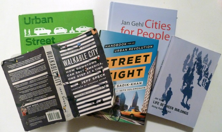
Our main reads for this trip – all of which are highly recommendable!

Expert meetings

In order to get a deeper understanding of the issues that the planners and designers are tackling here we are visiting some local colleagues here. We are going to visit the National Association of City Transportation Officials (NACTO) who have published excellent manuals regarding streetscape design. Urban and Transit Street Design guides and Urban Bikeway Design Guide all give an excellent answers not only to the question what should be done to streets but also good explanation of why and how these changes should be made.

After NACTO, we are meeting planners at WSP-Parsons Brinckerhoff and New York City Planning Department. We hope that these meetings will give us a better understanding how designs are put into practice here in NYC.

NACTO-manuaali.jpg
Boulevard design from NACTO’s Urban Street Design Guide, 2013

The solutions

Besides the readings and discussions with the planners we are of course looking at the actual solutions in real life. We are trying to experience the streets on NYC in diverse ways and with different modes of transportation. In this field research part we are trying to investigate the streets in order  – as Jeff Speck says about his book – not to explain why or how cities work but what works in the cities. We are going to look at the more permanent and interim design solutions that have been made in the streets and try to evaluate how they work.

We have started our studies on the streetscape and we got a good start by running and cycling about 10km through Manhattan in the Summer Streets event which will be the topic of the next traffic post.

-Tomi

Action research.jpg
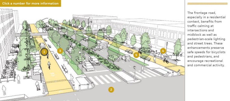
Helsinki City Planner learning from New York in action